
From the Pittsburgh left to the Immaculate Reception, Stentor Danielson wants every one of his maps to tell a story about the city.
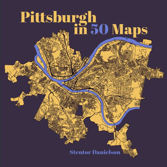
His new book, “Pittsburgh in 50 Maps,” is the fourth in a series of map-based compilations by Belt Publishing.
Before the Steel City, the Rust Belt-focused publishing company released books based on maps from Detroit, Cleveland and Buffalo — but Danielson thinks that Pittsburgh is special.
“That was kind of my overarching theme, that people who live in Pittsburgh really care about it,” Danielson said. “Even if they have very critical opinions about stuff … they’re doing that because they care about the city and they want it to be better.”
Danielson cultivated an interest in maps during his childhood when he read J.R.R. Tolkien’s “The Lord of the Rings.” He obtained his Ph.D. in geography and currently teaches in the environmental geosciences department at Slippery Rock University.
He also interviews authors for the New Books Network of podcasts, which is how he became aware of this series and decided to try his hand at mapping all of Pittsburgh’s dimensions.
While the book does contain conventional maps, most of the graphics in “Pittsburgh in 50 Maps” are more specific.
For example, Danielson chose to chart where the Catholic churches have historically been housed in the city — and how the ones that closed evolved into other buildings.
“What I hope is that readers will pick it up, and though you’re going to be drawn in by getting to see maps of things that you are already interested in, then they’ll also see some of the things that they might not have known about. They’ll learn something about another community in the city that they hadn’t known about, or another issue that affects the city that they hadn’t thought a lot about and be able to see how they all fit together,” Danielson said.
Danielson collected a wide range of data for the books, from maps provided by local, state and federal governments to information he collected on his own two feet.
“One of the maps that took the most work was one about the Pittsburgh left. I mapped out all of the traffic lights in the city and then for each one, individually, light by light, I zoomed in on it, on satellite view and sometimes actually went out to the corner in person to try to see if it was a corner where you might see somebody making a Pittsburgh left.”
Since there is no centralized database of every traffic light in the city, Danielson had to go through intersection-by-intersection to analyze for Pittsburgh left-ability.
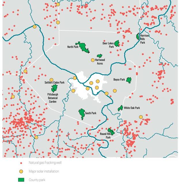
The book delves far deeper than just the present day. There’s plenty of history in “Pittsburgh in 50 Maps,” going all the way back to 300 million years ago and the geological events that lifted, eroded and sculpted our hills. Some land formation maps are more recent but still in the distant past.
“I’m talking about the geology that was laid down during the Ice Ages that creates the aquifer that we sometimes called the ‘fourth river.’ I was able to find the geological map showing exactly where that is located under the city,” Danielson said.
That “fourth river” is actually called the Wisconsin Glacial Flow, an aquifer that supplies groundwater to the region.
For those who like their history slightly more recent, there are also maps showing the many City of Pittsburgh boundary changes since its incorporation in 1794, all of the “firsts” achieved in the city and trolley transit maps from the mid-20th century.
Between all of the history, geography, geology and pop culture, Danielson was overflowing with ideas for different maps.
“You pretty quickly get to a list of 50, and then as I was working, I’d be working on one and think of an idea for something else. So then I would go back and be like, ‘All right, so out of what I’ve got here, what’s the most boring one that I could cut to put in this better idea?’”
There may, in fact, be slightly more than 50 maps in the book — and there’s always hope for a revision or second volume.
Danielson hopes that every Pitsburgher finds something fun in his collection of graphics.
“Whatever thing they think is interesting about Pittsburgh, there’s probably a map in there about it. And if not, I’m hoping the book inspires people to make their own maps.”
“Pittsburgh in 50 Maps”is available on Amazon and at other major retailers.